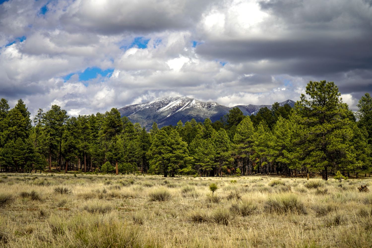
The climb that makes this drive spectacular is the same climb that makes it a winter trap. You leave Phoenix at about 1,100 feet in the warm Sonoran desert and finish at roughly 7,000 feet in Flagstaff's pines — and from December through March, the upper stretch of I-17 between the Sedona turnoff and Flagstaff regularly draws chain restrictions, snow-tire requirements, and outright closures when storms move through. It is entirely normal to set out in 70-degree sun and hit ice and whiteout by Munds Park. Your ears will pop on the way up. And in summer the same elevation that drops Flagstaff 25 to 35°F below Phoenix turns I-17 northbound into a Friday-afternoon parking lot as the Valley flees the heat, with the grade slowing trucks the whole way. The road is short; the mountain is real. Plan around the season and the weather and this is one of the great two-hour drives in the West.
As a piece of driving, Phoenix to Flagstaff is short and simple: about 145 miles and two and a quarter hours, almost all of it straight up Interstate 17 North. What makes it worth treating as a trip rather than a transfer is that you are not really driving 145 miles — you are driving up nearly 5,900 feet, through roughly four ecological life zones, in the time it takes to watch a movie. This guide sequences the climb stop by stop, names the one overlook genuinely worth pulling over for, and gives you the honest weather and traffic picture so the drive matches the season you are in.
A “life zone” is just a band of elevation with its own plants, temperatures, and feel — and you pass through a whole stack of them on this single drive. You start in the low Sonoran desert of saguaro and creosote, climb through high-desert grassland and chaparral past Sunset Point, drop into the pinyon-juniper and the Verde Valley where the first pines appear, and finish in the ponderosa-pine forest of the Colorado Plateau beneath the San Francisco Peaks. Few short drives anywhere in the country change this much, this fast.
The corridor itself is good interstate the whole way, but it is a working mountain road, not a flat desert run. The grade is real, the trucks are slow on the climbs, and the weather at the top tells you nothing about the weather at the bottom. Below is the stop-by-stop, an at-a-glance schedule table, and the practical notes — fuel, ears, altitude, and the winter-closure check — that keep this drive easy in any season.
Methodology
How this route was built and what the numbers are based on, so you can judge whether our calls match your trip:
- The route: the waypoints follow the actual I-17 North corridor between Phoenix and Flagstaff in real geographic order — Phoenix, the Sunset Point Rest Area, the Verde Valley around Camp Verde, the Sedona turnoff at SR-179 (exit 298), Munds Park, then Flagstaff. We did not invent a scenic detour; this is the road everyone drives, sequenced to make sense of the elevation gain rather than just the mileage.
- Distances, times, and elevation: the ~145 miles, ~2.25 hours, and ~5,900 feet of climb (about 1,100 ft at Phoenix to about 7,000 ft at Flagstaff) are honest round numbers for the I-17 leg, not false-precise readings. Treat any single figure as “about,” not to-the-minute — the grade, truck traffic, weather, and the Friday-afternoon rush all move the total, sometimes a lot.
- The elevation framing is the load-bearing fact: the “four life zones in two hours” and the desert-to-pine story come from the real ecology of central Arizona's elevation gradient — Sonoran desert, high-desert grassland and chaparral, pinyon-juniper, and ponderosa-pine forest, each a documented life zone you physically pass through on the climb. We weight the whole guide to elevation because it is what actually changes on this drive.
- The winter warning is not boilerplate: the chain-restriction and closure guidance reflects how I-17 above the Sedona turnoff actually behaves in winter storms, when the Arizona Department of Transportation restricts or closes the road. We tell you to check ADOT conditions before driving in the cold months because desert weather at the bottom is no guide to mountain weather at the top.
- What we name vs. what we don't: we name confirmed, durable places — the Sunset Point Rest Area, the Verde Valley / Camp Verde area, the SR-179 Sedona turnoff at exit 298, Munds Park, and Flagstaff's Route 66 downtown, Lowell Observatory, and Northern Arizona University. We point to categories (fuel and food in the Verde Valley) rather than vouch for a specific operator's current hours, which change. Last verified: 2026-06-13.
At a Glance: The I-17 Climb, Stop by Stop
| Stop | Place | ~Drive from Phoenix | ~Elevation | Why This Stop |
|---|---|---|---|---|
| The Climb — I-17 North, ~145 mi / ~2.25 hrs / ~5,900 ft up | ||||
| 1 | Phoenix departure (the Valley) | 0 mi — start | ~1,100 ft | Leave with a full tank. Sonoran desert, saguaro and creosote. In winter, check ADOT conditions for the climb before you commit. |
| 2 | Sunset Point Rest Area | ~60 mi / ~1 hr | ~3,200 ft | The one genuinely worthwhile free stop: a real overlook above the Bradshaw Mountains. Desert already giving way to high-desert grassland. |
| 3 | Camp Verde / Verde Valley | ~95 mi / ~1.5 hrs | ~3,150 ft | Where the desert hands off to pinyon-juniper and the first pines. A natural fuel-food-restroom stop; the climate change becomes obvious here. |
| 4 | Sedona turnoff (SR-179, exit 298) | ~105 mi / ~1.75 hrs | ~4,000 ft | The doorway to red-rock Sedona — a half-day detour, not a photo stop. Also the start of the steepest sustained climbing. |
| The High Country — Pines & the Summit | ||||
| 5 | Munds Park | ~125 mi / ~2 hrs | ~6,500 ft | Deep in the ponderosa forest, the last stop before town. In winter, roughly where desert drivers first hit snow and ice. |
| 6 | Flagstaff arrival (San Francisco Peaks) | ~145 mi / ~2.25 hrs | ~7,000 ft | The payoff: Route 66 downtown, Lowell Observatory, NAU, and the launch point for the Grand Canyon, Sedona, and Jerome. Take the first afternoon easy at altitude. |
The Climb in Detail: Phoenix Desert Up to the Pines
Stop 1 — Leaving Phoenix (the desert floor)
The drive starts in the heart of the Sonoran desert, at roughly 1,100 feet of elevation, with saguaro standing along the freeway and the McDowell and Bradshaw country off to the sides. Pick up Interstate 17 North out of the Valley and settle in. Fuel up before you leave the metro — not because services are sparse the way they are on the desert routes, but because the smart move on a mountain drive is to start full and never think about the gauge while you are paying attention to the grade and the weather.
If you are doing this in the cold months, do one thing before you commit: check the Arizona Department of Transportation's road conditions for I-17. The bottom of this drive tells you nothing about the top. I have left Phoenix in shirtsleeves under a hard blue sky and been in a snow squall ninety minutes later. In summer the calculus flips — the question is not weather but timing, because a Friday afternoon departure means joining the entire Valley's exodus to the pines.
The first stretch out of Phoenix is the gentlest of the whole drive. The Valley sprawl thins into open desert, the saguaro give way to creosote flats, and the road begins, almost imperceptibly at first, to tilt upward. You will not feel the climb yet. You will feel it soon.
Stop 2 — Sunset Point (the overlook worth stopping for)
About an hour north of Phoenix, after the road has wound down into and back out of the Agua Fria drainage, you reach the Sunset Point Rest Area — and this is the one stop on the drive I tell everyone to actually take. Most interstate rest areas are a restroom and a vending machine. Sunset Point is a genuine scenic overlook, perched with a wide-open panorama across the Bradshaw Mountains and the high desert you have just climbed into. It is free, it is right off the freeway, and on a clear day the view is the kind of thing people drive to on purpose.
By the time you stand at the railing here, you have already climbed to around 3,200 feet, and the change is visible: the pure low-desert saguaro country is behind you, and you are into high-desert grassland and chaparral — the second life zone of the day. The air is a little thinner and, depending on the season, noticeably cooler than the Valley you left. Stretch your legs, take the photo, and use the moment to register how much the landscape has already shifted in a single hour of driving.
Stop 3 — The Verde Valley and Camp Verde (desert hands off to pine)
North of Sunset Point the road climbs and then descends into the Verde Valley, the broad basin around Camp Verde where the Verde River runs and the transition from desert to forest finally becomes unmistakable. This is the part of the drive where, if you are paying attention, you can watch one ecosystem hand off to the next in real time: the pinyon and juniper thicken, the first real ponderosa pines start to appear, and the whole color of the country shifts from desert tan toward green.
Camp Verde makes a natural mid-drive stop — fuel, food, and restrooms — and it sits at a curious low point in the elevation profile, around 3,150 feet, before the road climbs hard again toward Flagstaff. Near here, around the Stoneman Lake exit, the ponderosa forest really begins to take over from the high desert. If you only register one stretch of the drive as “the moment it changed,” it will probably be this one. The Verde Valley is also a destination in its own right, threaded with its own small towns and history, but on this drive it functions as the hinge between the two halves of the climb.
Stop 4 — The Sedona turnoff (SR-179, exit 298)
At exit 298 you reach State Route 179, the turnoff for Sedona, and you face the one real decision of the trip. Sedona's red-rock country is one of the most photographed landscapes in the state, and the drive in on SR-179 is short and spectacular. But Sedona is a destination, not a quick detour — once you turn off, you will want at least half a day, and you will not regret it. If your goal today is Flagstaff and the clock matters, note the exit for a future trip. If your day is flexible, peeling off at 298 for Sedona and then climbing back up to Flagstaff afterward is one of the classic Arizona loops.
Whether or not you take the detour, the Sedona turnoff marks a real change in the drive itself: from roughly here, around 4,000 feet, the road begins its steepest sustained climbing. The grade you have felt as a gentle tilt becomes a genuine mountain pull, the trucks slow, and the engine note changes. The next twenty-odd miles are where you do most of the remaining climb to 7,000 feet, and it is where, in winter, the road most often runs into trouble.
Stop 5 — Munds Park (deep in the pines, last stop before town)
By the time you reach Munds Park, around 6,500 feet, you are unambiguously in the high country: ponderosa pine on every side, the air thin and cool, the desert a memory. Munds Park is a small pine-country community and the last roadside stop before Flagstaff, good for a final stretch, a coffee, or simply a moment to register that you have climbed most of a mile straight up since Phoenix.
In winter, Munds Park is also where the drive most often gets serious. This stretch of I-17 is high enough and exposed enough that desert drivers who set out under clear Phoenix skies frequently meet their first snow and ice right around here. If chain restrictions or a closure are going to bite, this upper section is where. In summer, by contrast, Munds Park is simply a cool, shaded, pleasant last break before town — a small preview of the mountain climate waiting in Flagstaff.
Stop 6 — Flagstaff (the payoff at 7,000 feet)
And then you crest into Flagstaff, at roughly 7,000 feet, with the San Francisco Peaks — Arizona's highest mountains — rising to the north. This is a real mountain town, not just a gateway: a walkable historic downtown built around the old Route 66 and the railroad, full of breweries, restaurants, and brick buildings from the timber-and-railway era. It is hard to overstate how complete the transformation is. Two hours and 145 miles ago you were among saguaro at 1,100 feet; now you are in a pine forest at 7,000, very possibly reaching for a jacket.
Flagstaff rewards a stop in its own right. Lowell Observatory, on a hill above town, is where Pluto was discovered, and it runs some of the best public stargazing programs in the country under genuinely dark skies. Northern Arizona University gives the place a college-town energy that keeps the downtown lively year-round. And the town is the launch point for the biggest trips in this part of the state — the Grand Canyon to the north, Sedona and its red rocks just south, and the historic mining town of Jerome beyond. One practical note as you arrive: 7,000 feet is high enough that visitors coming straight up from Phoenix, or from sea level, sometimes feel mild altitude effects. Take the first afternoon a little easy, drink water, and save the big hike for tomorrow.
Extend Your Trip: Where Flagstaff Takes You Next
Flagstaff is not just the top of the climb — it is the hinge for the best of northern Arizona. Once you have made the elevation gain, the marquee onward legs are all close, all in-state, and all live on The Lowdown Guide. Here is where the road goes next, nearest first.
Grand Canyon
About an hour and a half north of Flagstaff on US-180/AZ-64 — the natural next stop once you have made the climb to the high country. The single biggest payoff in the state, and Flagstaff is its closest real basecamp.
Red-rock countrySedona
Just south, either via the SR-179 turnoff you passed on the way up or down the scenic Oak Creek Canyon from Flagstaff. Red-rock landscapes, trails, and galleries — an easy add-on to either end of this drive.
Historic mining townJerome
The hillside copper-mining town in the Verde Valley southwest of Flagstaff — switchback streets, old saloons, and big valley views. A natural pairing with a Sedona or Verde Valley leg of the trip.
Practical Notes: Weather, Ears, Altitude, and Timing
Check the winter road before you drive
This is the one that catches Phoenix drivers out. From roughly December through March, the upper stretch of I-17 above the Sedona turnoff sees snow, and the Arizona Department of Transportation imposes chain or snow-tire restrictions — and, in real storms, full closures. The mistake is judging the drive by the weather outside your door in the Valley, which is no guide at all to conditions at 7,000 feet. Before you leave in the cold months, check current I-17 conditions and restrictions, carry warm layers regardless of how it looks in Phoenix, and be willing to turn around. The road reopens; a wreck on ice does not undo itself.
Your ears will pop
You climb nearly 5,900 feet in about two hours, most of it in the back half of the drive, so expect your ears to pop the same way they would on a flight — probably more than once. It is harmless. Yawn, swallow, or chew gum to equalize. It is also a useful, physical reminder of how much altitude you are gaining, which matters once you arrive.
Respect the altitude in Flagstaff
Flagstaff sits at about 7,000 feet, high enough that some visitors arriving from Phoenix — and especially from sea level — feel mild altitude effects on the first day: a little shortness of breath, a headache, faster fatigue on a climb. It is usually minor and passes as you acclimate. Take the first afternoon easy, drink more water than you think you need, go gentle on alcohol, and save the ambitious hike up the Peaks for the second day rather than the first.
Beat the traffic, not just the heat
In summer the entire Valley flees the 110-degree heat for the pines, and I-17 northbound becomes a Friday-afternoon and holiday-weekend parking lot, with the grade slowing trucks the whole way up. Sundays coming back are the mirror image. The fix is timing: drive midweek if you can, and if it has to be a weekend, get an early-morning start rather than joining the four-o'clock crowd grinding up the hill. The first big snow of winter draws sledding crowds toward Flagstaff too, so the same early-start logic applies in the cold months.
What to pack
- Layers, always: Flagstaff runs 25 to 35°F cooler than Phoenix, and the difference is dramatic at the top even in summer. Pack a jacket no matter how warm the Valley is.
- Winter gear in the cold months: if you are driving December through March, carry a warm coat, gloves, and an emergency blanket, and know whether your tires meet chain-restriction rules.
- Water: the altitude dries you out faster than you expect. Bring more than you would for a desert drive of the same length.
- A full tank out of Phoenix: start full so the gauge is never a worry while you are watching the grade and the weather.
- Sun protection: the high-elevation sun is stronger than it feels. Sunglasses and SPF even on a cool pine-country day.