This drive only makes sense from November through March. In summer you are pointing the car at one of the hottest inhabited places in the United States — Yuma runs 105 to 115°F from June into September — and every payoff on this route is outdoors and shadeless: a prison yard, open river parks, and an exposed dune sea. Drive it in July and you arrive somewhere you cannot safely walk at midday. Drive it in January and you arrive in the snowbird capital of the southwest corner, 70°F in the sun, with the prison, the river, and the dunes all genuinely enjoyable. The road is the same in every season; the destination is only a destination half the year. Plan around that one fact and this is one of the best short road trips in Arizona.
The Phoenix-to-Yuma run is short and straightforward as a drive: about 185 miles and roughly three hours, almost all of it on Interstate 8 West. What makes it worth treating as a trip rather than a transfer is what sits at the far end and what punctuates the middle. This guide sequences the whole thing — the two break stops that turn a 3-hour push into a comfortable half day, and the arrival order in Yuma that gets you to the dunes for the light instead of arriving after dark.
Yuma earns the drive on four counts that no other Arizona corner shares: a frontier territorial prison on the bluff above the Colorado, the army river-crossing history at the old Quartermaster Depot, deep Cocopah and Quechan river heritage, and the winter-lettuce farm country that grows most of the continent's cool-season salad. You can hit the headline two — the prison and the dunes — in a single long day, but a one-night stay is what turns this into a real trip and lets the dunes catch sunset.
The corridor itself is open Sonoran desert — flat, wide, and increasingly empty the further west you go. That is not a drawback so much as a thing to prepare for: fuel up before you leave the Valley, break at Gila Bend, and do not count on finding services on demand between there and Yuma. Below is the stop-by-stop, an at-a-glance schedule table, and the practical notes that keep a winter drive comfortable.
Methodology
How this route was built and what the numbers are based on, so you can judge whether our calls match your trip:
- The route: the waypoints follow the actual I-8 West corridor between Phoenix and Yuma in real geographic order — Phoenix, Gila Bend, Dateland, then Yuma and the dune country west of it on the Arizona/California line. We did not invent a scenic detour; this is the road everyone drives, sequenced for the cool season and for arriving with daylight left.
- Distances and times: the ~185 miles and ~3 hours are approximate driving figures for the Phoenix-to-Yuma leg on I-8, given as honest round numbers rather than false-precise readings. The Gila Bend midpoint and Dateland stop are positioned by their real places on the interstate. Treat any single figure as "about," not to-the-minute — traffic leaving the Valley and the pace you keep at the stops both move the total.
- Seasonality is the load-bearing fact: the November-to-March framing and the summer-heat warnings come from the Yuma corner's documented climate — among the hottest in the country, routinely 105 to 115°F in summer, with a winter snowbird season that more than doubles the local population. We weight every recommendation to "what month are you actually here," because the same outdoor stops that are excellent in January are unsafe at midday in July.
- What we name vs. what we don't: we name confirmed, durable places — the Yuma Territorial Prison State Historic Park, the Colorado River State Historic Park / Quartermaster Depot, the Imperial / Algodones Dunes, the Cocopah Museum near Somerton. For the roadside stops we point to the category (the Dateland date-shake stand; fuel and food at Gila Bend) rather than vouch for a specific operator's current hours, which change.
- Refresh cycle: seasonal heat guidance and the winter framing re-checked each quarter; state-park hours and dune-area access re-verified before each November season. Last verified: 2026-06-10.
At a Glance: The I-8 Route, Stop by Stop
| Stop | Place | ~Drive from Phoenix | Time There | Why This Stop |
|---|---|---|---|---|
| The Drive — I-8 West, ~185 mi / ~3 hrs | ||||
| 1 | Phoenix departure (the Valley) | 0 mi — start | — | Leave in the morning with a full tank. South and west out of the metro to pick up I-8. An early start banks afternoon daylight for the dunes. |
| 2 | Gila Bend | ~75 mi / ~1.5 hrs | 20–30 min | The reliable midpoint fuel-food-restroom stop. Top off here; services thin out west of town across the open desert. |
| 3 | Dateland — date-shake stop | ~120 mi / ~2 hrs | 20–30 min | The classic I-8 date-shake stand in Medjool-date country. A genuine roadside tradition and a second break before the final push. |
| Yuma — Arrival & the Corner (cool season) | ||||
| 4 | Yuma Territorial Prison State Historic Park | ~185 mi / ~3 hrs | 1–2 hrs | The signature stop on the river bluff. Walk it morning or late afternoon — never midday, even in winter. Explains why the town exists. |
| 5 | Colorado River State Historic Park (Quartermaster Depot) | Adjacent to prison | 45–60 min | The steamboat-era army supply hub on the crossing. Pairs with the prison for the river-history half-day. |
| 6 | Imperial / Algodones Sand Dunes (AZ/CA line) | ~20–30 min W of Yuma | Golden hour | The payoff. California's largest dune sea, best at the edges of the day. Time arrival for sunset light; midday summer sand is dangerous. |
| 7 | Cocopah heritage near Somerton (optional 2nd day) | ~15–20 min S of Yuma | 1 hr | The lower-Colorado river-people's story. The crossing was a Native crossing first — an hour here is well spent if you stay over. |
The Drive in Detail: Phoenix Out to the Corner
Stop 1 — Leaving Phoenix
The whole trip starts with one decision: leave early. In the cool season Yuma's daylight is the resource you are spending, and the dunes at the far end are a sunset stop. Pull out of the Valley in the morning, head south and west to pick up Interstate 8, and settle in. Fuel up before you leave the metro — this is the last place you should treat fuel as casual until Gila Bend.
The drive out of Phoenix shades quickly from suburb to open desert. Within 40 minutes the Valley sprawl gives way to creosote flats and distant ranges, and the road runs flat and fast. There is little to do but settle into the rhythm, which is exactly why the two break stops matter: they give the drive shape and keep a three-hour run from feeling like a transfer.
Stop 2 — Gila Bend (the midpoint)
Roughly an hour and a half out, Gila Bend is the natural midpoint and the commit point. It is a small highway town — fuel, food, restrooms, and not much else — but its position makes it essential. West of Gila Bend the desert opens up and services get genuinely sparse, so this is where you top off the tank and refill water bottles whether or not you feel you need to. Treat it as the last reliable stop before Yuma rather than an optional one.
If you have time and curiosity, Gila Bend is also the turnoff point for some of the remote desert country to the south, but for this route it functions as a clean 20-to-30-minute reset: stretch, fuel, go.
Stop 3 — Dateland and the date shake
Further west, the I-8 corridor runs through date-growing country, and Dateland is the long-standing roadside institution that goes with it. The signature is the date shake — a thick milkshake blended with locally grown Medjool dates — and the stop is a genuine tradition rather than a manufactured attraction. It doubles as a fuel and restroom break at a point on the drive where you will want one.
This is the kind of stop that earns its place on a first-timer or family run more than on a solo dash. We are pointing you to the category — the date-shake stand at Dateland — rather than vouching for any single operator's current hours, which shift seasonally. Either way, it marks the last leg: from here it is a straight, short run into Yuma.
Stop 4 — Arrival: the Territorial Prison
Cross into Yuma and head for the bluff above the Colorado River crossing, where the Yuma Territorial Prison sits as the corner's signature stop. Built by the inmates themselves starting in 1876, it held more than 3,000 prisoners over its 33 years before the state penitentiary moved to Florence in 1909. The surviving cell blocks, the iron-strap "dark cell," the sally port, and the guard tower are now a State Historic Park, and the on-site museum does an honest job of separating the dime-novel legend from the documented record.
The single most important piece of timing advice for the whole trip: walk the prison in the cool of the day. If you arrive mid-afternoon in winter, you are fine; if you somehow find yourself here at noon in the shoulder months, wait for the light to soften. The prison yard is open and shadeless by design, and the heat that makes Yuma a winter-only destination is felt most acutely standing on that bluff.
Stop 5 — The Colorado River crossing and Quartermaster Depot
A short walk from the prison, the Colorado River State Historic Park preserves the old Yuma Quartermaster Depot — the army supply hub that received goods by steamboat and dispatched them to every fort across the Arizona and New Mexico territories. Between the two parks, the reason a town exists in this furnace of a place finally makes sense: the river crossing was the whole game. For centuries this was the one reliable place to cross the lower Colorado, used by the river's Native peoples, then by Spanish missionaries, then by the Forty-Niners pouring west toward the California gold fields.
Together the prison and the depot make a tidy river-history half-day. If you are doing the trip as a single long day, this is your turnaround point before heading back east — but the better move in winter is to stay over and add the dunes at sunset.
Stop 6 — The Imperial / Algodones Sand Dunes (the payoff)
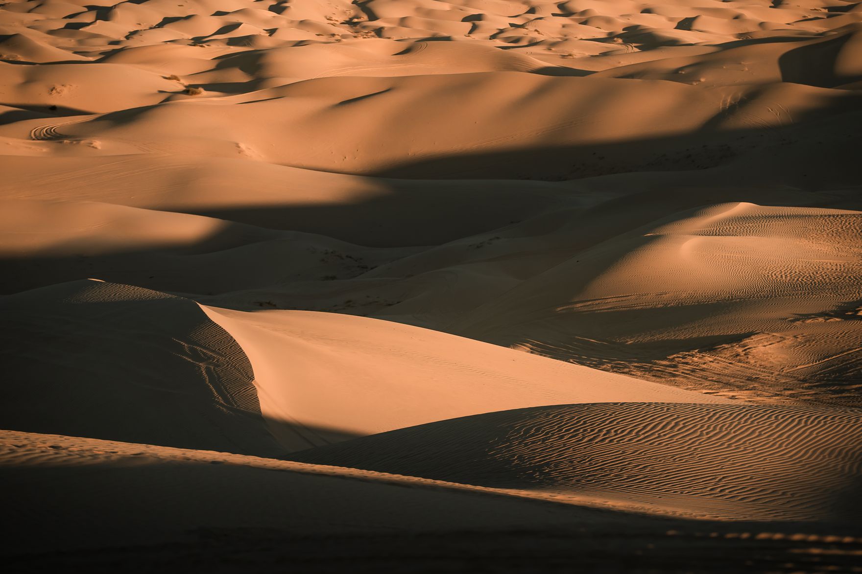
Drive 20 to 30 minutes west of Yuma on I-8 and the desert floor gives way to a true sand sea: the Imperial Sand Dunes, also called the Algodones Dunes, the largest dune system in California, riding right along the Arizona border. In the cool months they fill with off-highway-vehicle riders, dune buggies, and sandboarders — this is one of the premier OHV grounds in the Southwest. Even if you never touch a throttle, the dunes are worth the drive for the landscape alone: the long shadows of late afternoon turn the ridgelines into something that has, in fact, doubled for the Sahara and for alien deserts in major films.
Two cautions. First, timing — go at the edges of the day for the light, and treat midday summer sand as genuinely hazardous. Second, terrain: viewing and walking the established edges needs nothing more than a regular car and sturdy shoes, but driving out onto the soft open sand is real off-highway terrain that requires an appropriate vehicle and permits. Most visitors simply park, walk in a short way, and watch the light. That is the move this itinerary recommends.
Stop 7 — Cocopah and Quechan heritage (if you stay over)
It is easy to treat Yuma as a frontier-army story and stop there, and it would be a mistake. The lower Colorado is the homeland of river peoples — the Cocopah (Kwapa) and the Quechan (Yuma), among others — who farmed the floodplain, fished the river, and controlled the crossing for centuries before any territorial soldier arrived. The Cocopah Tribe operates the Cocopah Museum and cultural center near Somerton, south of Yuma, with exhibits on the tribe's history, traditional basketry, and the long relationship between the people and the river.
If your trip is a single day, this is the stop to come back for. If you are staying over, an hour with the Cocopah and Quechan side of the story — learning their own names for this country — is among the most worthwhile and respectful things a visitor can do in the corner, and it is the half of Yuma the prison-and-old-West framing tends to erase.
Onward from Yuma: The Door into California
Yuma is not just an endpoint — it sits right on the Arizona/California border, which makes it the natural hinge between an Arizona trip and a California one. If you are building a longer southwest loop rather than an out-and-back, this is where the map opens up.
Continue west on I-8 and you cross immediately into California's Imperial Valley, the low-desert agricultural basin that is the California-side continuation of the same farm-and-dune landscape around Yuma — the western reaches of the Algodones dune system spill across the state line here. Push on and the corridor carries you up toward Palm Springs and the wider Coachella Valley resort country. Due south of the corner lies the Mexican border town of Los Algodones, which gives the whole junction its international edge: this is genuinely the place where Arizona, California, and Mexico nearly touch.
We mention these places because they are geographically honest at this exact spot on the map — the natural next moves out of Yuma. Dedicated Lowdown Guide coverage of the California desert is on the roadmap, not live yet, so there is nothing to click through to here; treat this as orientation for where the road goes next, not a link.
Practical Notes: Fuel, Heat, and Timing
Fuel and water
Leave Phoenix with a full tank and fill again at Gila Bend — do not skip it. The stretch from Gila Bend to Yuma is open desert with sparse services, and the margin you build at the midpoint is the margin that keeps the drive relaxed. Carry water in the car regardless of season; in a region this hot, a breakdown without water is a different kind of problem than it would be elsewhere.
The heat is the whole plan
This bears repeating because it governs everything: Yuma is a winter destination. November through March, daytime highs sit in the 65 to 75°F range and the snowbird season more than doubles the town's population. June through September it is routinely 105 to 115°F and the outdoor stops on this route — the prison yard, the river parks, the dunes — range from uncomfortable to genuinely dangerous at midday. If your only option is a summer trip, drive at dawn, see the prison early, and treat the dunes as a sunrise or post-sunset stop only.
Dust storms are a real hazard on this same calendar. Arizona's monsoon season runs June 15 through September 30 — the identical window that makes Yuma dangerously hot — and the open desert highways this route uses can produce sudden, dense dust storms that drop visibility to zero. ADOT's rule is simple: never drive into a dust wall. If one is ahead, get off the highway completely as soon as you can (do not stop in a travel lane or on the shoulder), then set the parking brake and turn off every light, including your flashers and brake lights, so trailing drivers don't follow your lights into the dust. Full guidance is at ADOT's "Pull Aside, Stay Alive" campaign (PullAsideStayAlive.org).
Day trip vs. overnight
A round trip is about 370 miles and six hours of driving. As a single day it works for the prison and the depot but forces you to skip the dunes at their best and the heritage sites entirely. One night in Yuma is the honest recommendation: it turns a tiring out-and-back into a proper short trip, lets the dunes catch sunset, and opens a relaxed second morning for the Cocopah Museum or a winter farm tour.
What to pack
- Sun protection: hat, sunglasses, and SPF even in winter. The prison yard and the dunes have zero shade.
- Layers: winter desert days are warm but nights drop fast — into the 40s. A jacket for the evening.
- Closed shoes for the dunes: soft sand and a regular sneaker is fine for walking the edges; nothing technical needed unless you are riding.
- Water in the car: more than you think you need, for the desert stretch between Gila Bend and Yuma.
- A full tank out of Phoenix and again out of Gila Bend.
Book Things to Do in Yuma
Dune-country outings, river and history experiences, and guided activities in the Yuma corner can be browsed and booked in advance on Viator. Advance booking matters most in the November–March high season, when the snowbird crowd fills the corner.
Yuma & the Corner
Browse tours and activities around Yuma — the river-history sites, the dune country, and seasonal experiences — bookable in advance for your winter visit.
Browse Yuma-Area Tours on ViatorPlan the Trip Itself
New to the corner? Start with the full Yuma hub for the four anchors, the snowbird-season playbook, and the day-trip ring before you drive.
Read the Full Yuma Guide